


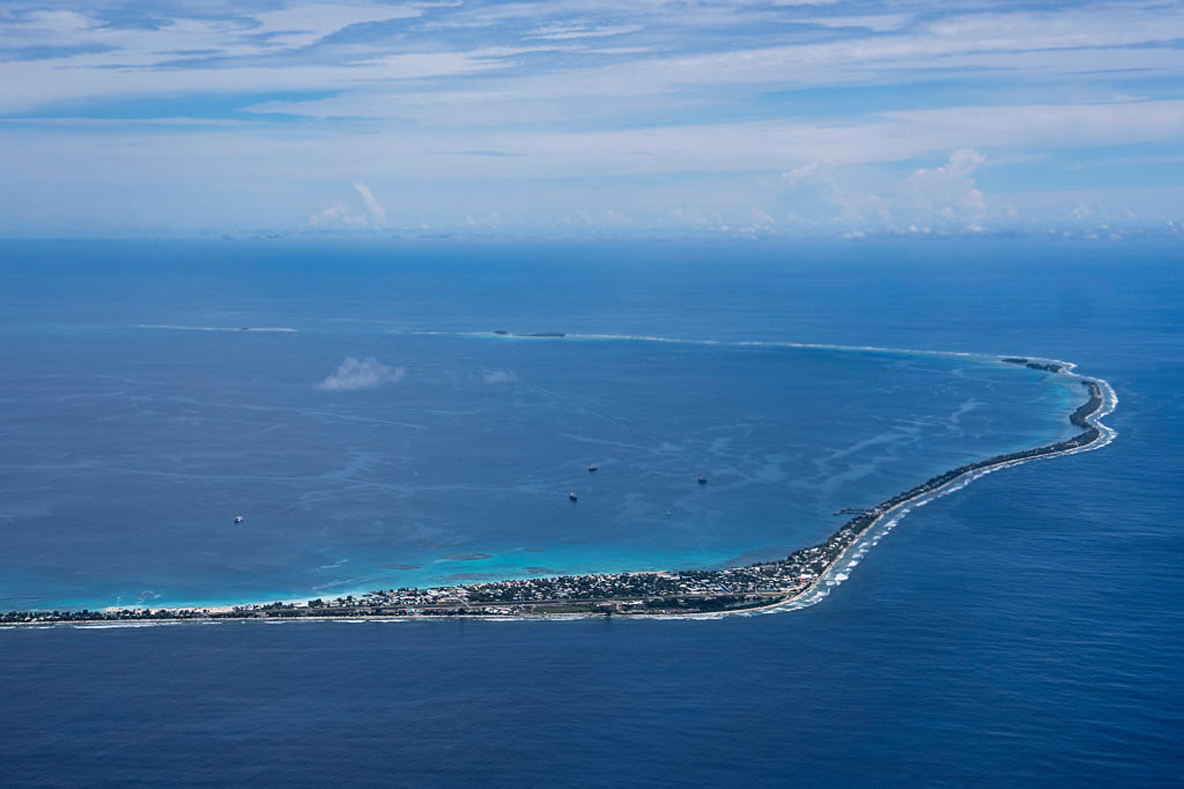
The South China Sea is more than a body of water; it is a critical artery of the global economy and a complex arena of overlapping territorial ambitions. Its strategic value is defined by its geography: a semi-enclosed sea bordered by some of the world’s most dynamic economies, connecting the Pacific and Indian Oceans via the Strait of Malacca. An estimated US$3.37 trillion in global trade, or one-third of global maritime shipping, transits through these waters annually. For China, it is a vital conduit for over 80% of its energy imports and nearly 40% of its total trade. The conflict here is not abstract; it is a direct contest over the control of physical space—islands, reefs, and the maritime corridors that connect them.
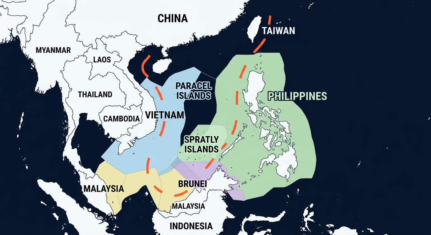
At the heart of the spatial dispute is the collision of two fundamentally different interpretations of maritime law. On one side are the Exclusive Economic Zone (EEZ) claims made by Vietnam, the Philippines, Malaysia, Brunei, and Indonesia, which extend 200 nautical miles from their coastlines as defined by the United Nations Convention on the Law of the Sea (UNCLOS). On the other is China’s expansive ‘nine-dash line’—expanded to a ‘ten-dash line’ in 2023 maps—a vaguely defined historical claim that encompasses nearly 90% of the South China Sea, directly overlapping with its neighbors’ EEZs. This cartographic contest creates a web of disputed zones, transforming vast areas of open water into potential flashpoints.
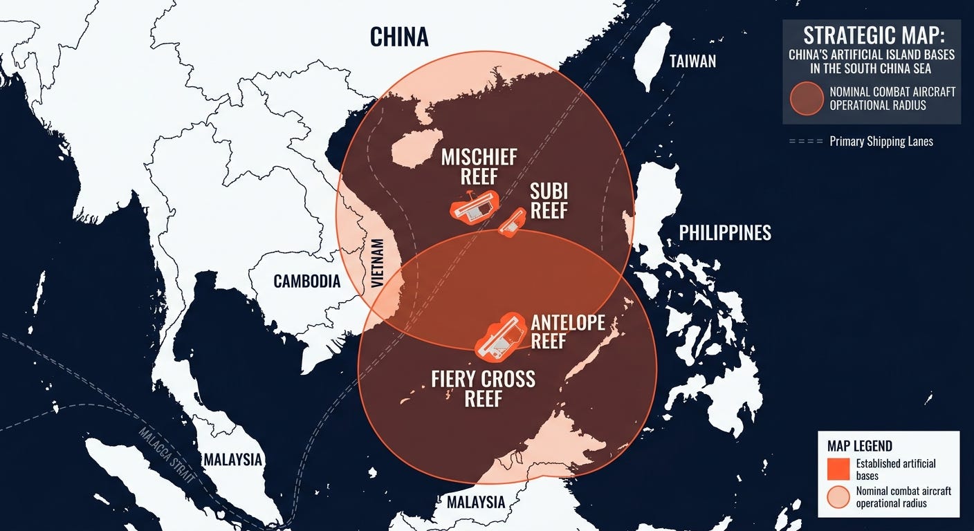
The abstract lines on maps are being translated into concrete reality through an unprecedented campaign of island-building. Since 2013, China has physically altered the geography of the South China Sea, creating over 3,200 acres of new land in the Spratly Islands alone. Low-tide elevations and submerged reefs have been dredged and built up into artificial islands capable of hosting significant military infrastructure. This activity is not random; it is a deliberate strategy to create a network of unsinkable forward operating bases, fundamentally changing the strategic calculus in the region. These outposts allow for the projection of air and naval power across the sea’s vital shipping lanes.
Recent activity has focused on the Paracel Islands, claimed by China, Taiwan, and Vietnam, but under Beijing’s control since 1974. Beginning in late 2025, China initiated a massive dredging and landfill project at Antelope Reef. Satellite imagery from March 2026 confirms that the reclaimed landmass has reached approximately 1,490 acres, potentially making it China’s largest outpost in the entire South China Sea, rivaling or exceeding Mischief Reef in the Spratlys. The scale and design of the reclamation, with a long, straight outer edge, suggests the potential for a 9,000-foot runway, similar to those on Woody Island, Fiery Cross, and Subi Reefs. Such an installation would dramatically extend China’s operational reach, enabling persistent surveillance and flexible deployment of military assets across the northern half of the sea, much closer to Vietnam’s coast.

This network of artificial islands functions as a system of spatial control. Fiery Cross, Subi, and Mischief Reefs in the Spratlys form a strategic triangle, each equipped with airfields, naval berths, and radar arrays. These installations allow China to monitor and potentially interdict maritime and air traffic throughout the southern portion of the sea. The addition of a major base at Antelope Reef in the Paracels creates a layered defense and power projection capability, covering the sea’s northern expanses. This militarization is not merely defensive; it provides the infrastructure to enforce China’s jurisdictional claims, challenging the freedom of navigation that is a core principle of international maritime law and a key strategic interest for nations like the United States. In response, the U.S. regularly conducts Freedom of Navigation Operations (FONOPs), sailing warships within 12 nautical miles of these features to legally challenge the territorial sea claims China attaches to them.
Beneath the waves, another layer of geography fuels the conflict: the distribution of natural resources. The U.S. Energy Information Administration estimates the South China Sea holds around 11 billion barrels of oil and 190 trillion cubic feet of natural gas in proved and probable reserves. While not as vast as reserves in the Persian Gulf, they are significant for the energy-hungry littoral states. Crucially, most of these hydrocarbon basins are located along the continental shelves of the coastal nations, falling squarely within their claimed EEZs but also inside China’s nine-dash line. This overlap transforms the seabed into contested economic territory. The competition extends to living resources; the sea is one of the world’s most productive fishing grounds, but overfishing and territorial disputes, often enforced by Chinese coast guard and maritime militia, have devastated fish stocks and created constant friction, particularly with Filipino and Vietnamese fishing fleets.
The geography of the South China Sea is actively being rewritten. The creation of new land where none existed before is a profound act of geopolitical engineering, designed to create facts on the ground—or in the water—that are difficult to reverse. By building a network of militarized outposts, China is not just asserting a legal claim; it is building the physical capacity to enforce it, challenging the established spatial order of the region. This strategy transforms the sea from a global commons into a zone of contested control, where the physical placement of runways, harbors, and missile batteries could determine the future of regional stability and global trade.