


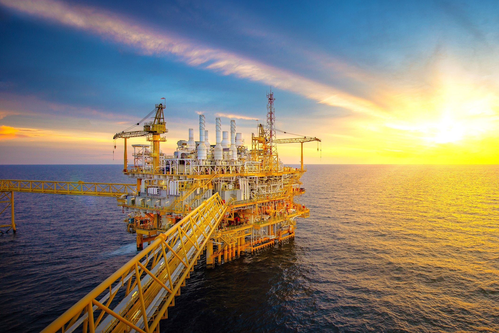
The Eastern Mediterranean, a sea lane of empires and trade for millennia, is the theater for a new, high-stakes geopolitical contest. The discovery of vast natural gas reserves since 2009 has transformed the seabed into a three-dimensional chessboard, where energy security, maritime law, and national ambition collide. The geological wealth of the Levant and Nile Delta Basins is not merely an economic opportunity; it is a catalyst redrawing sovereign boundaries, forging new alliances, and reigniting ancient disputes. To understand this shifting landscape, one must first understand its geography.
The spatial distribution of these resources is the core of the issue. Major discoveries like Egypt’s Zohr field (discovered 2015), Israel’s Leviathan (2010) and Tamar (2009) fields, and Cyprus’s Aphrodite field (2011) are clustered in a relatively compact maritime area. Zohr, the Mediterranean’s largest discovery, lies approximately 190km north of Port Said, Egypt. Leviathan is about 130km west of Haifa, Israel. This proximity means the Exclusive Economic Zones (EEZs)—the 200-nautical-mile area of resource sovereignty granted by the UN Convention on the Law of the Sea (UNCLOS)—of Egypt, Israel, Cyprus, Lebanon, and Turkey overlap and intersect in a complex web of claims and counter-claims.
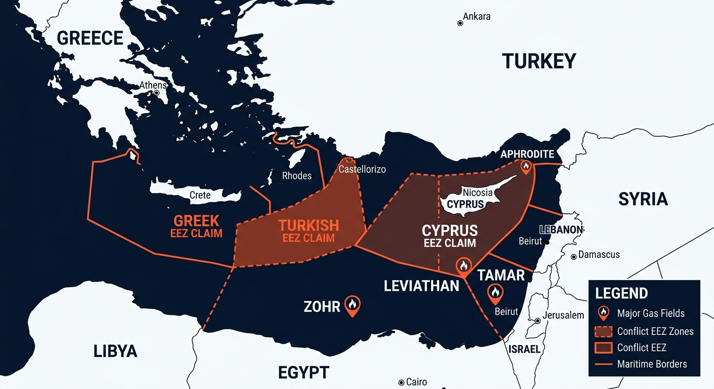
These overlapping claims are where geology becomes geopolitics. The most acute spatial conflict involves Turkey, Greece, and Cyprus. Turkey, not a signatory to UNCLOS, disputes the EEZ claims generated by Greek islands like Crete and Kastellorizo, arguing that a country’s continental shelf should be the primary determinant. This interpretation directly clashes with Greece’s UNCLOS-based claims, creating a vast contested maritime zone. Furthermore, Turkey’s recognition of the Turkish Republic of Northern Cyprus complicates drilling rights around the entire island, directly challenging the internationally recognized government of Cyprus’s authority to award exploration licenses for fields like Aphrodite.
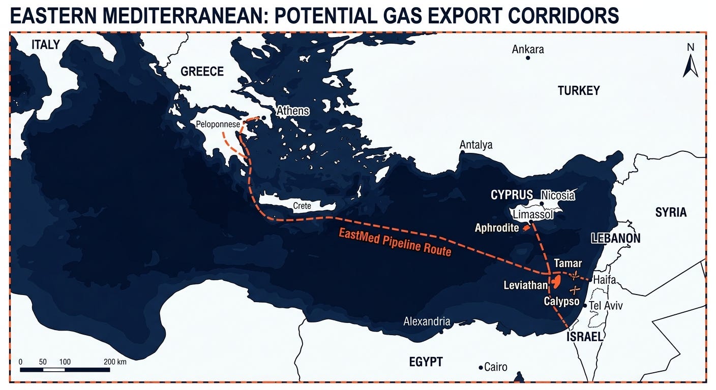
The friction is visualized most dramatically by the 2019 Turkey-Libya maritime deal, which drew a line across the Mediterranean, claiming a shared economic zone that ignores the waters of Crete and other Greek islands. This move is a direct geographical challenge to the proposed EastMed pipeline, a project designed to link Israeli and Cypriot gas fields to Europe via Greece. By creating a legal and spatial barrier, Ankara has forced a regional recalculation of energy transit.
The geography of export infrastructure reveals the resulting strategic alignments and competitions. With Europe keen to diversify away from Russian gas, the question is not just who owns the gas, but who can deliver it. Two primary export models have emerged, each defined by a distinct spatial logic. The first is the pipeline model, epitomized by the ambitious—and now stalled—EastMed pipeline. This 1,900 km subsea pipeline was designed to create a new energy corridor, physically connecting the gas fields of Israel and Cyprus to Crete, mainland Greece, and onto Italy. This route would have bypassed Turkey, solidifying a pro-Western energy axis. However, its immense cost, technical challenges at depths of 3km, and the Turkey-Libya maritime corridor have rendered it largely unfeasible as of 2025-2026.
The second, and currently more viable, model is centered on Egypt. Egypt possesses the region’s only Liquefied Natural Gas (LNG) terminals at Idku and Damietta. This existing infrastructure makes it the most logical geographic hub for liquefying and re-exporting Israeli and Cypriot gas globally. This spatial advantage has fostered a pragmatic alliance, with Israel already exporting significant quantities to Egypt via subsea pipeline. **This positions Cairo as the indispensable energy middleman, able to convert regional gas into a globally traded commodity, a stark contrast to the fixed, politically charged path of a pipeline.** This LNG-centric strategy offers flexibility but also concentrates the region’s export capacity in a single geography, subject to Egypt’s own domestic demand and political stability.
The future map of the Eastern Mediterranean is being drawn by these energy flows. Unresolved maritime borders, such as the one between Israel and Lebanon over the Qana and Karish fields (resolved in 2022), show that diplomacy can redraw lines on the map to unlock resources. The ongoing dispute between Cyprus and Israel over the shared Aphrodite-Yishai reservoir is another example where geology forces political negotiation, with a final agreement reportedly near in early 2026. These bilateral agreements are slowly creating a de facto map of accepted claims, even as larger disputes with Turkey persist.
The ultimate question is whether these underwater resources will fuel integration or conflict.** The establishment of the Eastern Mediterranean Gas Forum (EMGF) in 2020, which includes Egypt, Israel, Greece, Cyprus, Italy, Jordan, and the Palestinian Authority, but excludes Turkey, represents an attempt to create a formal bloc based on this new energy geography. It is a political space defined by shared economic and security interests, arrayed against what they perceive as Turkish expansionism. The coming decade will reveal whether this energy-driven alignment can create a stable and prosperous regional order or if the seabed chessboard will become a battlefield of overlapping claims, turning a source of immense wealth into a catalyst for profound instability.